Gnesen Township, 13 miles north of Duluth, had been contemplating the installation of lighting for the town hall flagpole for some time. When Township...
The most important document underlying Google’s proposed data center in Adolph is the City of Hermantown’s 2045 Comprehensive Plan. The city would not have...
Managed by Accessible Space Inc. out of St. Paul, the Burke Apartments serve tenants with mobility issues and other physical disabilities. On Aug. 13,...
Your comment, though meant to be silly, is more accurate than you know. In a landscape of steep clay, the rare areas of level ground are valued for all uses. Today, portions of the Skally Line have been repurposed for walking paths, cross-country ski trails, roads, power-line corridors, and, yes, even mountain bike trails. A long section of the Duluth Traverse mountain bike trail is built on a bench of land that was notched out of the hillside for the Skally Line, and is still held up by Skally Line retaining walls.
There is no map available of the Skally Line in Jay Cooke. The park does not mention the line at all, which I’ve often wondered about. Many sections are the line are gone. In some places, it has been replaced by Highway 210. There are some sections remaining.
The Ogantz Trail follows the Skally Line for half a mile or so, where the trail is closest to the river. The grade is fairly evident.
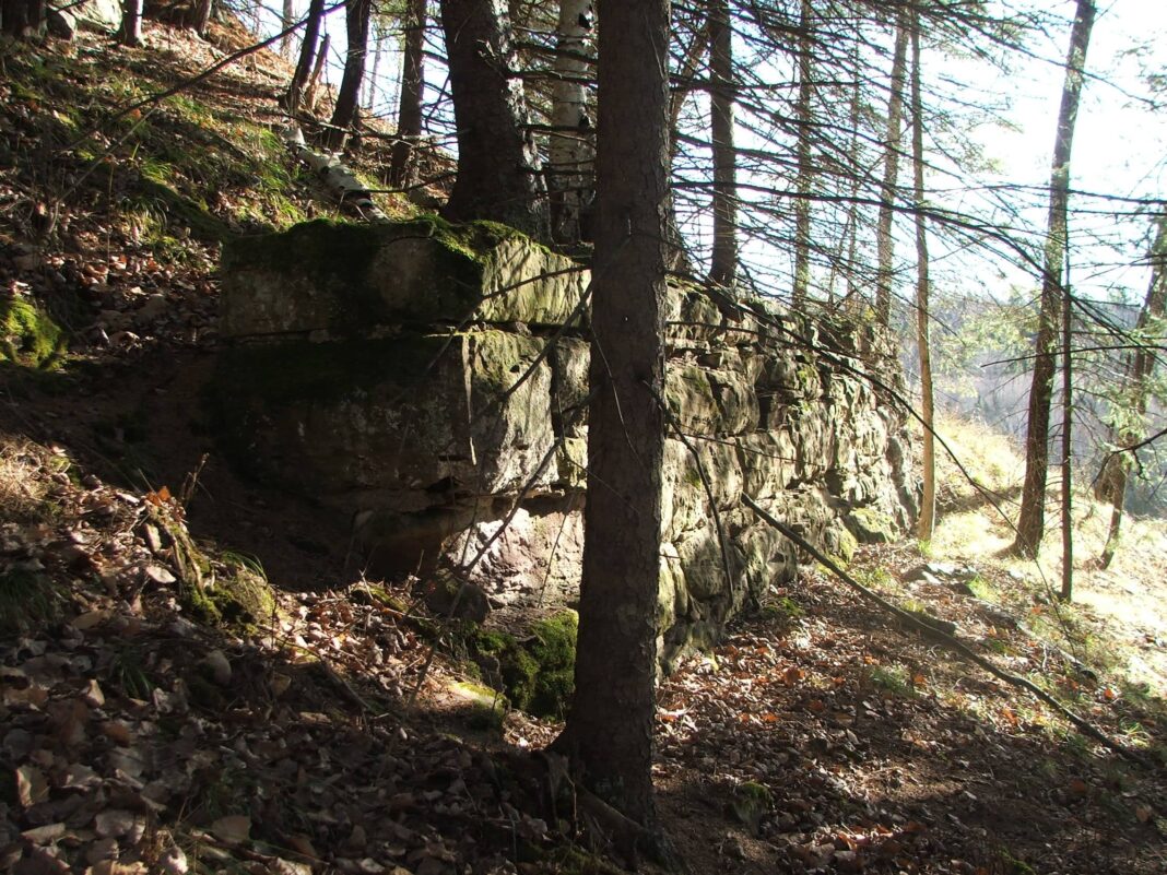
Longer sections of the original grade may be found outside of Jay Cooke. If you start at Chambers Grove Park in Fond du Lac, you can follow the St. Louis River mountain bike trail along the river. For nearly a mile, this trail follows the old Skally Line grade, which is supported from below by massive sandstone retaining walls. The tops of these walls may be spotted here and there in the shrubbery. Old culverts and legacy railroad ties may also be seen.
If you park at the Perch Lake fishing pier at 121st Avenue West and Highway 23, you can follow the Skally Line east along the river, over a series of causeways.
There are no official trails leading to any of the Skally Line’s trestle footings, which are located on very steep terrain; independent exploration is required.
If you paddle up the river from Chambers Grove you can see some of the retaining walls as well. Also there is a mention of the LS&MR on the new nature walk in Chambers Grove–see this photo of the placard. https://drive.google.com/file/d/1qdIhiO2Ju2W5VgdFd4NStYp8DX3X4MBd/view?usp=sharing
Right behind the placard you can see where the rail bed is with a spur that heads towards the river, or it’s what I believe it to be.
John has done a wonderful job capturing the current condition of the line. You can search the web and find a ton. You can also go to http://www.lsmrr.org to find the current volunteer organization that is keeping the feel of travel from back in the day alive.








Nice clear photos. Kudos!
That would be a good place for a mountain bike trail.
Your comment, though meant to be silly, is more accurate than you know. In a landscape of steep clay, the rare areas of level ground are valued for all uses. Today, portions of the Skally Line have been repurposed for walking paths, cross-country ski trails, roads, power-line corridors, and, yes, even mountain bike trails. A long section of the Duluth Traverse mountain bike trail is built on a bench of land that was notched out of the hillside for the Skally Line, and is still held up by Skally Line retaining walls.
Is there a map to follow some of the Skally Line in Jay Cooke?
There is no map available of the Skally Line in Jay Cooke. The park does not mention the line at all, which I’ve often wondered about. Many sections are the line are gone. In some places, it has been replaced by Highway 210. There are some sections remaining.
The Ogantz Trail follows the Skally Line for half a mile or so, where the trail is closest to the river. The grade is fairly evident.
Longer sections of the original grade may be found outside of Jay Cooke. If you start at Chambers Grove Park in Fond du Lac, you can follow the St. Louis River mountain bike trail along the river. For nearly a mile, this trail follows the old Skally Line grade, which is supported from below by massive sandstone retaining walls. The tops of these walls may be spotted here and there in the shrubbery. Old culverts and legacy railroad ties may also be seen.
If you park at the Perch Lake fishing pier at 121st Avenue West and Highway 23, you can follow the Skally Line east along the river, over a series of causeways.
There are no official trails leading to any of the Skally Line’s trestle footings, which are located on very steep terrain; independent exploration is required.
If you paddle up the river from Chambers Grove you can see some of the retaining walls as well. Also there is a mention of the LS&MR on the new nature walk in Chambers Grove–see this photo of the placard. https://drive.google.com/file/d/1qdIhiO2Ju2W5VgdFd4NStYp8DX3X4MBd/view?usp=sharing
Right behind the placard you can see where the rail bed is with a spur that heads towards the river, or it’s what I believe it to be.
John has done a wonderful job capturing the current condition of the line. You can search the web and find a ton. You can also go to http://www.lsmrr.org to find the current volunteer organization that is keeping the feel of travel from back in the day alive.