

In the summer of 2025, while navigating through the City of Duluth’s Parks & Recreation webpage, I encountered the administration’s startling claim that Duluth had 162 parks. As someone who is familiar with the city’s green spaces, I could only think of several dozen parks in the city.
I soon learned that the city had pulled this statistic from Appendix B of the Duluth Essential Spaces Plan, which had been approved by the City Council in October of 2022. I also discovered that the city was including all sorts of green spaces in their “parks” category—even roadway medians and tiny, overgrown parcels with no road or trail access. In addition, a number of “parks” on the list were not even owned by the city; some were owned by the State of Minnesota and others by private parties.
All 162 spaces (including the privately-owned ones) are currently outlined in green on the city’s online Parks and Trails map, to signify that they are “parks.”
I decided to visit all of the listed parks, from smallest to largest, and to post video recordings of my excursions. The project took ten months: I visited Park #162 (Fountain of the Wind) on July 15, 2025 and Park #1 (the Frederick Rodney Paine Nature Preserve) on May 15, 2026.
Duluth’s smallest parks: Fountain of the Wind and the Gladstone Cul-de-sac
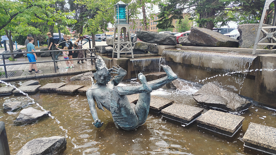
At 0.06 acres, Fountain of the Wind is a public art installation located in the heart of the Canal Park business district, where Buchanan Street meets Canal Park Drive. Built in 1993 by Douglas Freeman, the installation features bronze sculptures of fish and the mythical “Wild Cat Dreaming” in a pool equipped with water jets to keep water arcing through the park. The installation also includes stepping stones, so visitors can walk amongst the cool bronze wildlife on hot summer days.
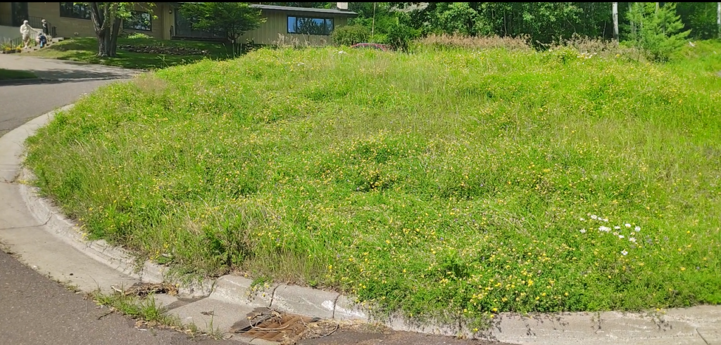
Also at 0.06 acres, the Gladstone Cul-de-sac is a circle of overgrown grass located at the end of Gladstone Street in Lakeside. For my big trek, I made sure to bring along a backpack with survival gear and drinking water. A few neighbors eyed me curiously for the duration of my two-minute hike, but none ventured into the wilderness to speak with me.
Islands and medians
In the Essential Spaces plan, “parkways” are defined as “landscaped areas of distinct quality within, or adjacent to, the public right of way.” The Gladstone Cul-de-sac and ten other parks on the list fall into this category.
Park #157—Wallace Cul-de-sac
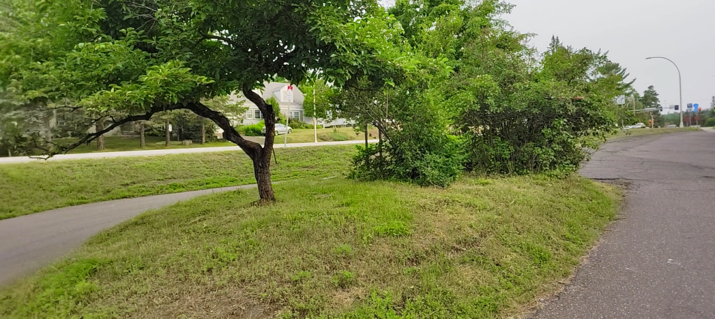
Duluth’s least impressive park is located on the corner of Arrowhead Road and Woodland Avenue. It consists of the dead-end stub of Wallace Avenue and a strip of grass which runs parallel to Woodland Avenue. A small island in the middle of the pavement features two or three crabapple trees and a lilac bush, granting visitors an opportunity to commune with nature next to one of the busiest intersections in the city. No birds were sighted in the shrubbery, but an Impala was observed racing past the park.
Park #154—Granitoid Memorial Park
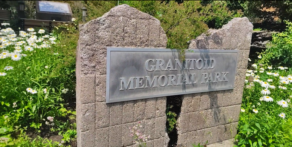
Granitoid Memorial Park was the first park on the list which resembled a traditional park. Located on the small triangular parcel at the intersection of Clover Street, Irving Place, North 25th Avenue East, and 7th Street, the 0.15-acre park features shady trees, tended gardens, historical exhibits, benches, and even running water. This park honors the first concrete street built in Minnesota, which was designed to accommodate motorized and equestrian traffic. Small rectangles were scored in the granitoid pavement to provide better footing for horses. Built in 2004, Granitoid Memorial Park is landscaped with features constructed from historical pavement remnants.
Park #143—Arrowhead Road Island
Touring the Arrowhead Road Island was the most kinetic experience of the project. I had to dart across two lanes of Arrowhead Road to get to it, as traffic rushed by in both directions. Located just west of Kenwood Avenue, the traffic island had recently been mowed and featured several spruce and mountain-ash trees. It was slanted steeply in the middle portion, so I had to take care not to tumble into oncoming traffic. When I reviewed the video afterwards, I appreciated how the automatic captioning referred to the street as “Airhead Road.”
One table, please
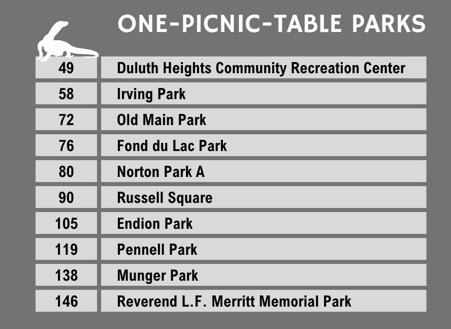
Some parks on the list had multiple picnic tables; others had none. Ten parks, however, featured only one, singular picnic table.
Park #146—Reverend L. F. Merritt Memorial Park
The smallest one-picnic-table park is Park #146, the Reverend L.F. Merritt Memorial Park. At 0.29 acres, this park’s name is more impressive than the space itself. It consists of a strip of lawn and a few trees at the foot of the Bong Bridge, next to 46th Avenue West. The Reverend Leonidas F. Merritt’s family was well-known for helping to develop the Iron Range in the 19th century. Today, a public statue of Leonidas presides over the town of Mountain Iron, 70 miles north of Duluth.
Leonidas served as pastor of the Leonidas F. Merritt Methodist Episcopal Church, which was located on the park site in the late 1850s. After the church was relocated in 1921, much of the site was redeveloped as the adjacent industrial area expanded and the Bong Bridge was erected. Because nothing identifies this park by name, it is unlikely people zipping on or off the bridge realize it exists. A single picnic table sits quietly in the shade at the RLFMMP. During my visit, the supports for one of the seats were bent, so that the seat was mere inches off the ground.
Park #49—Duluth Heights Community Recreation Center
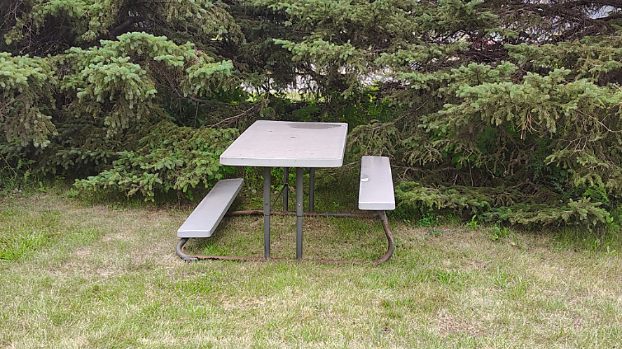
The largest park featuring a single picnic table is Park #49, the Duluth Heights Community Recreation Center. At 14.24 acres, this park features soccer fields, outdoor ice rinks, a playground, a section of undeveloped forest, and a community center (though the building has been closed since 2020). But when it comes to picnic tables, the DHCRC has only one, sitting indifferently on the uneven lawn near the playground.
Parks along the Lake Superior shoreline
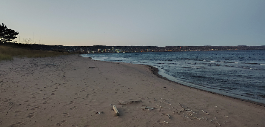
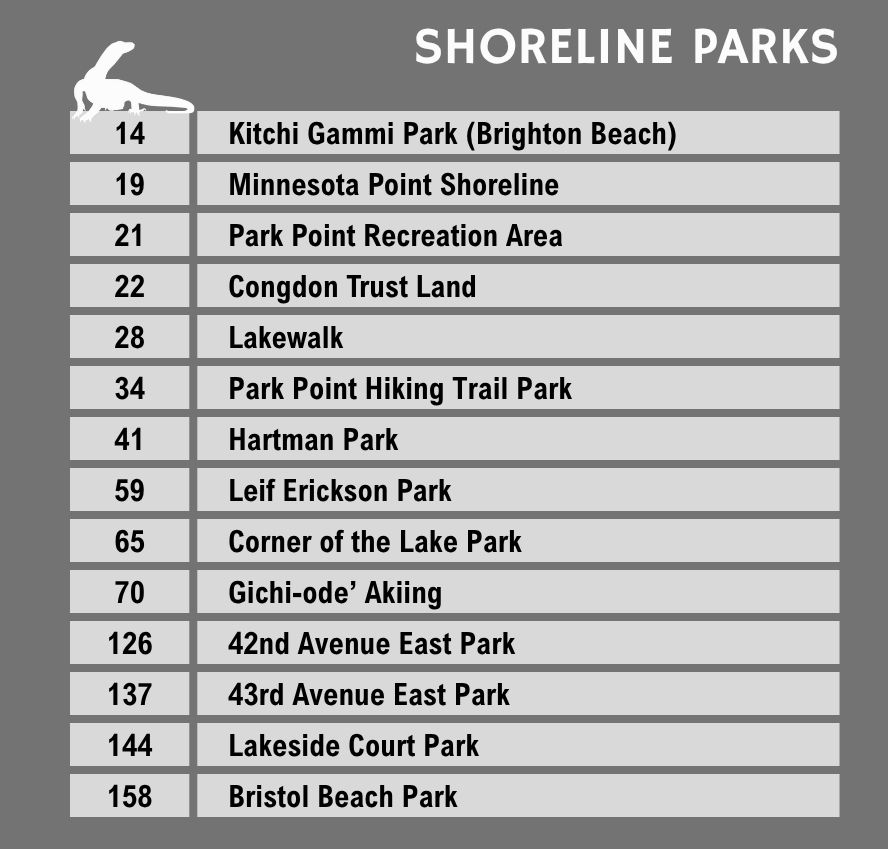
The majority of the Park Point beach—from the Lift Bridge to the end of Minnesota Point—is owned by the city. The Lakewalk runs along Lake Superior in the other direction, from Canal Park to 26th Avenue East, before it turns inland. In addition, more than four miles of shoreline, from the mouth of the Lester River to McQuade Harbor, is also owned by the city.
In total, 14 parks on the list share an estimated 13 miles of shoreline along Lake Superior—possibly a world record for Lake Superior waterfront owned by a single municipality.
Park #22—Congdon Trust Land
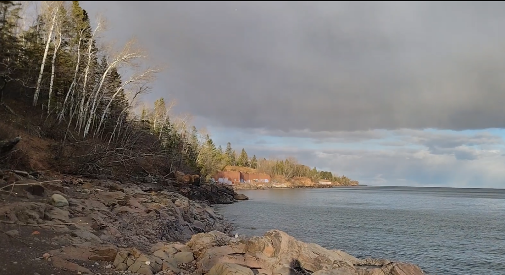
More than three miles of Lake Superior shoreline (from 78th Avenue East to McQuade Harbor) is part of the Congdon Trust Land. The city purchased the property in 1915, encouraged and assisted financially by iron mining magnate Chester Congdon, who desired to see a roadway built between Duluth and Two Harbors. Today, that road is known as Scenic Highway 61.
When the City Council authorized the purchase, the ordinance stated that “the land so acquired shall be forever used by the City for the purposes for which the same was condemned, and that the City of Duluth shall never use the same for any purpose other than as a road, highway or boulevard, and shall never dispose of the same or any part thereof.” This stipulation has protected this stretch of the shoreline for more than a century.
The Congdon Trust Land can be seen from a few small overlooks along Scenic Highway 61. The steep, unmaintained social trails down to the beach can be challenging to negotiate. If anyone is seeking a solitary Lake Superior experience in a city of 86,000 people, the Congdon Trust Land is ideal. When I recorded my video on Nov. 9, 2025, I was able to walk completely undisturbed along the rocky, cobbled shoreline for 17 minutes.
Park #126—42nd Avenue East Park
Though I have resided in Duluth for almost three decades, I had never been introduced to the popular 42nd Avenue East Park until I tasked myself with this project. The one-acre park is accessed by driving toward Lake Superior on 42nd Avenue East from London Road, parking at the dead end of the block, and following a short trail down to the shore. Bedrock outcroppings and a small cobble beach offer the general public an outstanding Lake Superior experience in a neighborhood where the majority of the shoreline is privately owned.
The bushwhacking parks
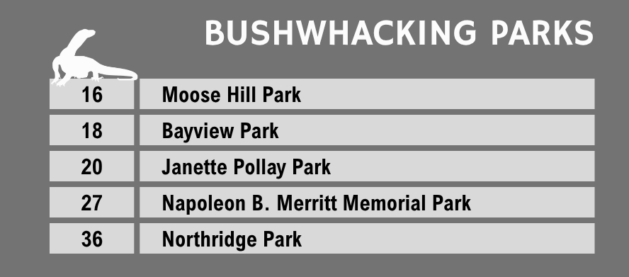
Five of the parks on the list were accessible only by bushwhacking—thrashing through the woods without the benefit of a trail. All five were new to me.
Park #16—Moose Hill Park
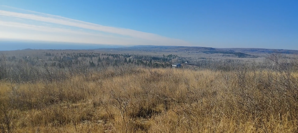
Before I set out to explore Moose Hill Park, I wrongly assumed its name referred to Moose Mountain, a state-owned natural area located north of Duluth. Moose Hill Park is an 81-acre parcel south of Moose Mountain, entirely surrounded by private property. The only way to access the park (without trespassing on private property) is via a couple of street easements off of Montauk Lane, in the East Ridge Estates neighborhood.
After pinpointing one of the street easements on the St. Louis County Land Explorer, I hoped the authorities wouldn’t be summoned as I began my bushwhacking trip along the property line of an $800,000 home. The woods were unremarkable—aspens, paper birches, and thickets of buckthorn—but I ascended the terrain until I emerged on a ridgetop offering a magnificent view of Lake Superior. I hung out on the ridge for over an hour.
Moose Hill Park is located on tax-forfeited land owned by the State of Minnesota. Because the City of Duluth does not own the property, there is no reason for this park to be included on their list of parks. Nevertheless, the city identifies it as a “park” on their official map.
Private parks
Nine private parcels are referred to as “parks” on the city’s interactive Parks and Trails Map, with no reference to their ownership. It is conceivable that someone might attempt to visit them and wind up with a trespassing violation.
I was excited when I saw Mall Drive Park on the list. It is a 32-acre parcel of forest near Texas Roadhouse which I had never explored before. Imagine my disappoinment when I discovered it was owned by Home Depot, and therefore closed to public exploration.
On Sept. 28, 2025, when I bushwhacked down a utility easement in Duluth Heights, hoping to catch a glimpse of Sonside Park, I emerged from the woods to find a concerned neighbor standing in his driveway, wondering why I was wandering around near his backyard. This park is owned by Sonside Investments Inc., not by the City of Duluth, and is essentially a landlocked piece of greenspace in the middle of a housing development.
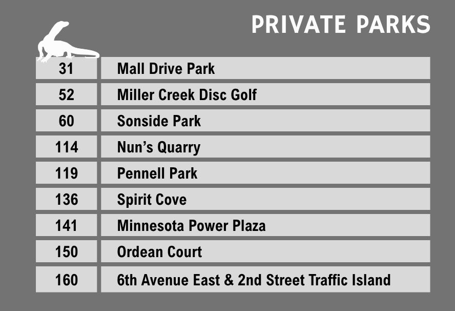
In my opinion, the city should remove privately-owned “parks” from their list unless the public has permission to use them. Minnesota Power Plaza, on the corner of Lake Avenue and Superior Street, is an example of a privately-owned park which is open to the public.
When I emailed the city, asking if it was legitimate to include privately-owned parcels on their parks list, the brief answer I received on June 10, 2026, suggested that the city did not share my concern. The city wrote only: “On the outdoor rec map, there is only one color—green—for public lands. Some private lands have public access easements, which may trigger them to appear to be public property or publicly accessible.”
The city did not indicate that they had any intention of correcting the private parcels which “appeared” public on the map.
The wild west
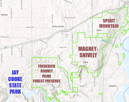
Duluth’s three largest parks—the Spirit Mountain Recreation Area, Magney-Snively Park, and the Frederick Rodney Paine Forest Preserve (FRPFP)—are all adjacent to each another in the western section of Duluth. Collectively, they encompass nearly 5,000 acres of greenspace. Jay Cooke State Park, which shares a border with the FRPFP, adds nearly 9,000 more acres to the contiguous parkland. One could conceivably walk from 63rd Avenue West, in Duluth, to Wrenshall, Minnesota—about 15 miles as the crow flies—and only have to cross two public roads.
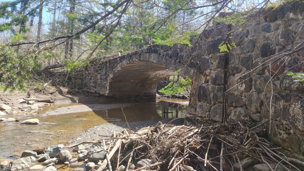
The primary FRPFP trail runs from Beck’s Road to Highway 210. The 2.2-mile trail follows the old Skyline Parkway route, which was abandoned in 1958. The relatively easy hike, which crosses interesting historical bridges and offers nice views of Mission Creek, is an excellent introduction to Duluth’s wildest area. The main trail also provides hikers access to more difficult trails in the woods.
Biggest surprises
Park #70—Gichi-ode’ Akiing
My biggest surprise was that so many people were unfamiliar with Gichi-ode’ Akiing Park. Formerly known as Lake Place Park, Gichi-ode’ Akiing (“A Grand Heart Place”) is located entirely atop infrastructure built over Interstate 35. It was constructed when the freeway was extended through downtown Duluth in the late 1980s. Gichi-ode’ Akiing overlooks the Lakewalk and features trees, gardens, lawns, a central plaza, benches, short walls (which double as benches for visitors), and international public art pieces.
Mushrooms and other fungi thrive in Gichi-Ode’ Akiing Park. I have found puffballs the size of soccer balls in the park, and I even happened to find one while recording my video.
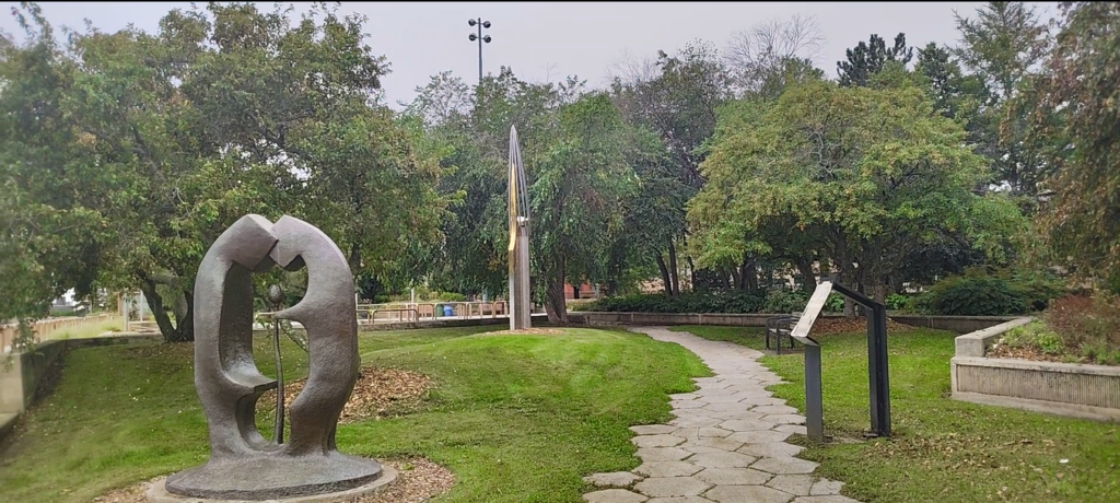
The entrance to Gichi-Ode’ Akiing Park, located across from the NorShor Theater on Superior Street, provides the most direct access point to Lake Superior from downtown. I was surprised by the number of comments from locals who didn’t know this city park existed.
Park #69—Pleasant View Park
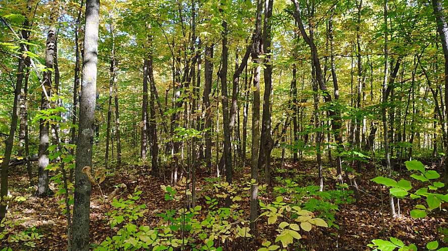
While Duluth has a lot of green space, it doesn’t have many high-quality hardwood forests. Much of Duluth’s parkland is filled with aspens, paper birches, impenetrable thickets of buckthorn, and other invasive species; the latter choke out the understory and prevent hardwoods from reproducing. The three Wild West parks offer nice hardwood stands, but accessing them takes effort.
I was pleased to find that Pleasant View Park, a 4.5-acre parcel on Pleasant View Road (north of Woodland), was home to an excellent stand of maple, basswood, yellow birch and other hardwoods–and very little buckthorn. The trees are not old-growth giants, but the park as a whole provides a snapshot of a vigorous hardwood forest. Seedlings, saplings and full-grown trees create a multi-layered forest which signals resilience and health. When I visited, in late September, the leaves were just beginning to change color.
The land was originally purchased and cleared by the Duluth Commercial Club in 1907. They had planned to sell lots large enough for homesteaders to plant gardens, so they could supplement their income by growing food—a popular trend at the time.
The land ownership was transferred to the University of Minnesota in 1911, as part of a larger land sale for the creation of the university’s “Northeast Demonstration Farm and Experimental Station.” After operating for over 60 years, the Northeast Agricultural Station closed in 1976.
Today, Pleasant View Park is partially owned by the City of Duluth and partially by the State of Minnesota, as tax-forfeit property. If you would like to walk through a healthy hardwood forest, this is the city park for you. A small clearing off Pleasant View Road provides a convenient place to park.
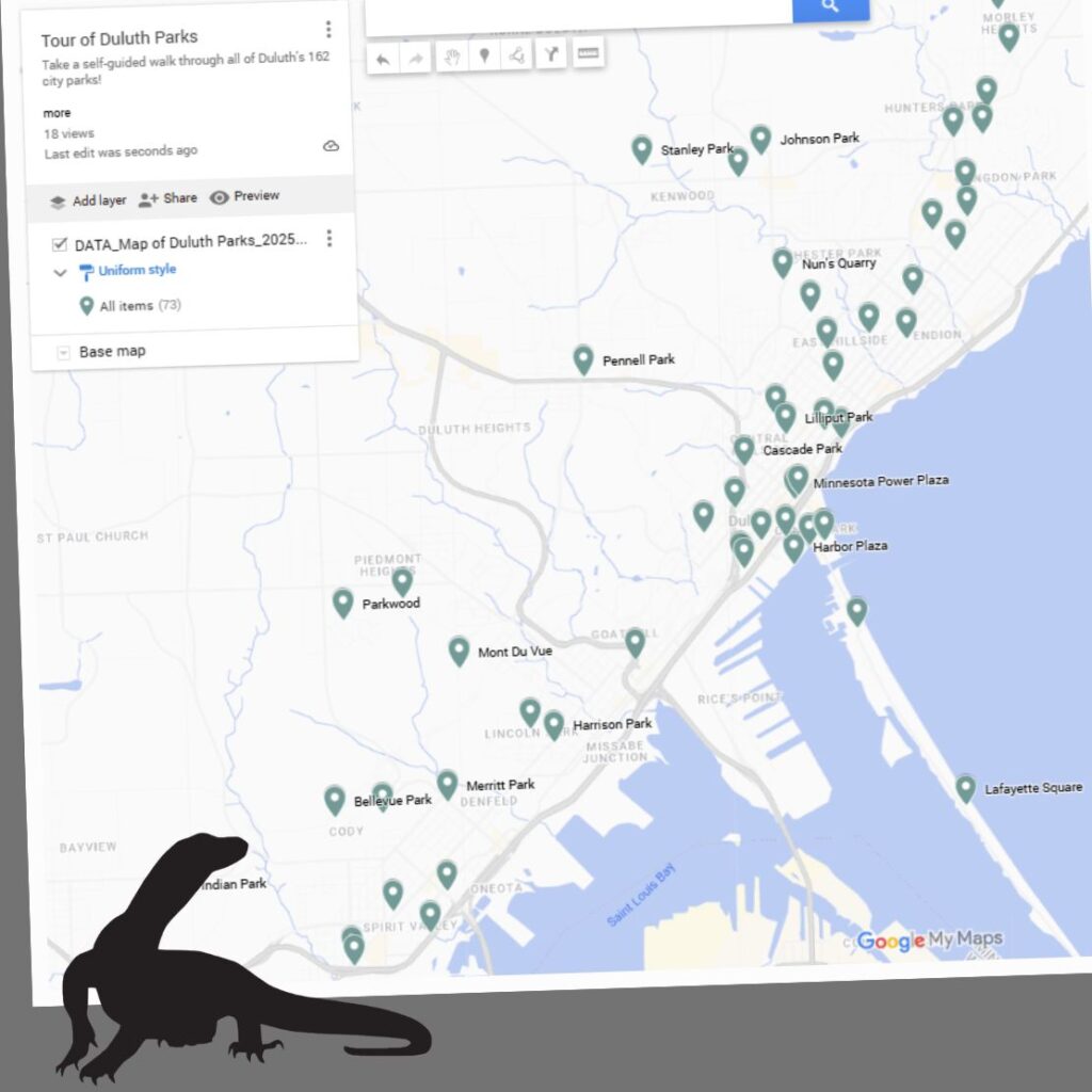
Please click on the map below to access videos and information about any of the 162 parks: