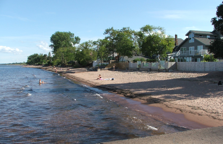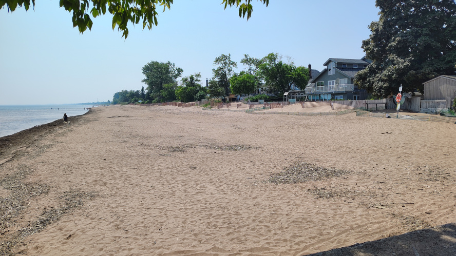


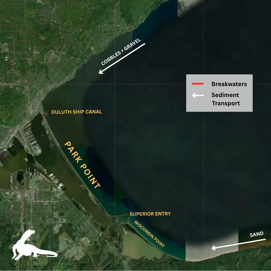
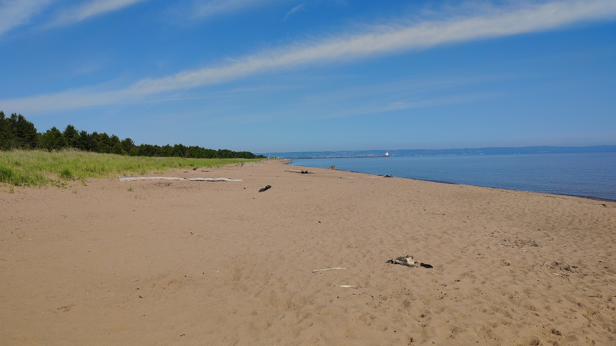
Duluth’s Park Point (also known as Minnesota Point) and Wisconsin Point, in Superior, are natural lake bars which were formed by wind and waves depositing sediment at the head of Lake Superior. Sediment coming from the lake’s South Shore via nature’s “conveyor belt” is primarily sand, while sediment coming from the rockier North Shore consists of coarse gravel and cobbles.
Park Point is approximately seven miles long and Wisconsin Point three miles long. The two points meet at the Superior Entry, a natural waterway at the south end of Park Point which connects Lake Superior to the inner harbor. A second entry, the man-made Duluth Ship Canal, is located at the north end of Park Point. Breakwater structures are located at both entries and extend 1,500 to 2,000 feet out into the lake.
When the breakwaters were built, more than a century ago, the natural flow of sediment to Park Point from both the North and South Shores was impeded. Thus, while Park Point continues to erode, it is no longer naturally replenished with sand and cobbles, as it was before the breakwaters existed. During periods when water levels are significantly elevated, the Park Point beach erodes dramatically, to the point that area residents are concerned about losing their homes.
By contrast, the beach of Wisconsin Point features an abundance of sand, because the breakwaters at the Superior Entry now halt the South Shore sediment conveyor belt in Wisconsin.
Section 111
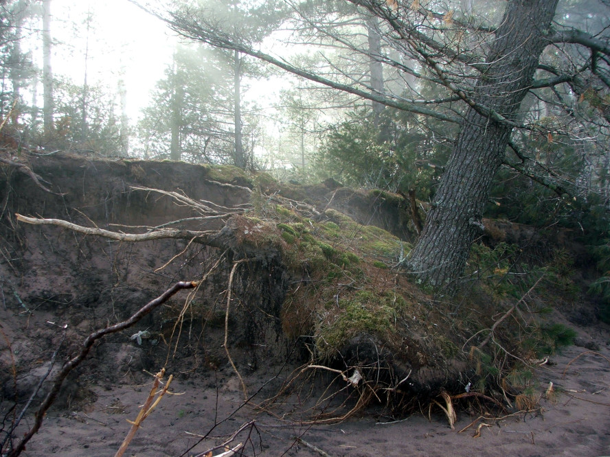
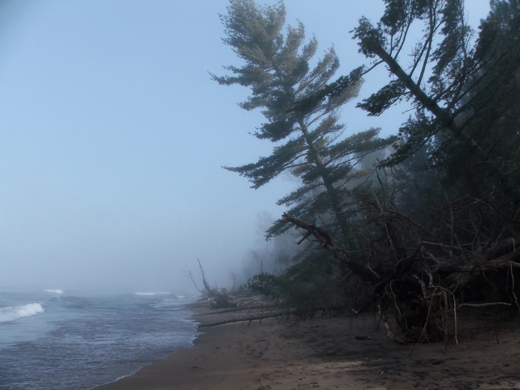
During the most recent period of elevated water levels on Lake Superior, between 2017-2019, the beach on the north end of Park Point was greatly diminished and portions of some residents’ backyards were swept away by the waves. On the undeveloped south end, hundreds of trees toppled into the water as the waves consumed the soil beneath them. The City of Duluth responded by asking the U.S. Army Corps of Engineers, which manages the breakwaters, to conduct a Section 111 study.
Under Section 111, the Corps studies issues of concern allegedly caused by federal navigation properties under their control. The goal of the study is to determine if this is true. If the Corps finds that their federal properties are contributing to the problem, they help design and implement a mitigation project.
The Park Point 111 process began in 2022. According to the city’s Director of Parks, Properties and Libraries, Jim Filby Williams, the study is currently in the “final internal review stage,” but he is unsure when the report will be completed or released.
The final report will quantify the level of the Corps’ culpability, expressed as a percentage—are the breakwaters 30 or 70 percent responsible for Park Point’s erosion, or some other amount? The Corps will then contribute the same percentage of funds to the final mitigation project (up to $12.5 million).
Filby Williams said the final number is very important for the city, as the city’s ability to fund a mitigation project is limited. “If it’s 50/50, hypothetically, we would have an extraordinarily difficult time meeting the non-federal financial contribution requirement,” he said. “If it’s 80/20 or 90/10, that’s still really hard for us, but this is a resource of statewide significance and we can engage our state partners [to help with funding]. That’s probably a solvable problem, and so this current phase, which we’re approaching the end of, is very consequential.”
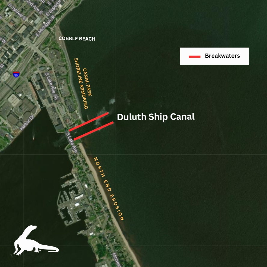
According to the city’s technical advisor on the project, UMD Professor of Earth and Environmental Sciences John Swenson, the locations most susceptible to erosion are those immediately on the “downdrift” side of the breakwaters. On the north end of Park Point, this area of the beach is approximately half a mile long (between the Duluth Ship Canal and the 12th Street S-curve); on the south end, it is the section that borders the Minnesota Point Pine Forest State Natural Area. These two areas suffered most during the high-water period of 2017-2019, and will likely be the main focus of the mitigation project when the study is completed—especially the populated north end.
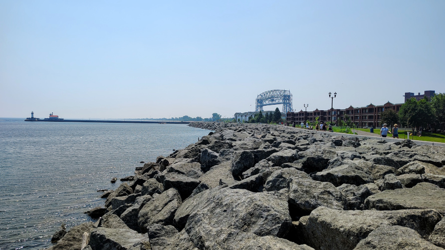
Erosion will continue to affect both private property and Duluth’s public beach on Park Point. Swenson says that simply armoring the shoreline with concrete or stone—as might have been done in the past—would only shift the problem to a different section of the Point, because waves would bounce off the armoring material and strike the shoreline elsewhere, with undiminished force. According to Swenson, an armoring scenario “just passes that [wave energy] down the coastline.”
Filby Williams pointed out that armoring shorelines also tends to obliterate beaches altogether, a scenario the city wanted to avoid. “Hardening shoreline in any fashion … accelerates and locks in the permanent loss of a recognizable, usable beach—and so one of the city’s commitments has been to say we are only going to consider remedies that preserve a recognizable, usable, natural beach,” said Filby Williams.
He pointed to the Canal Park business district as an example, where much of the shoreline has been armored and where a beach no longer exists.
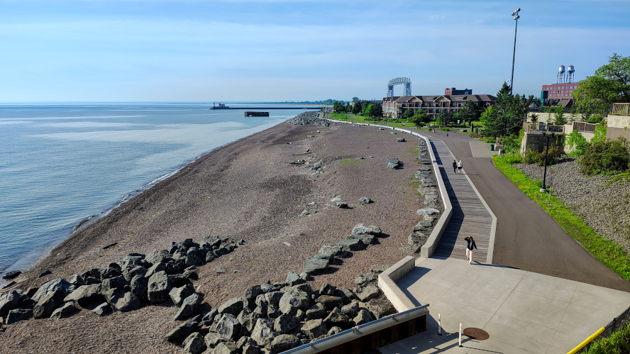
Swenson and Filby Williams said the best option for reducing erosion may be to build offshore underwater breakwater structures, to absorb wave energy before the waves reach the shoreline. These structures have been previously installed along Duluth’s Lakewalk.
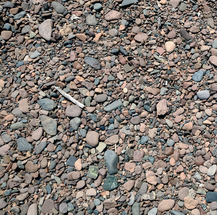
Cobble dunes?
Today, the entire seven-mile Park Point beach consists of sand. In the pre-breakwater days, however, a cobble beach of gravel and water-smoothed stones stretched southward more than a mile from the mainland—where North Shore sediment retired—and the cobble beach transitioned to sand further south. Wisconsin Point, naturally replenished by Lake Superior’s South Shore, has always had a sand beach.
A remnant of Park Point’s cobble beach can still be found in Canal Park, in the “corner” of the lake, near the Endion Station Inn. It is one of the Lakewalk’s most popular sites.
Park Point’s north end has a sand beach today because harbor dredging operators have been replenishing the sand there for over a century. Disposing of dredge material has been an ongoing concern throughout the port’s existence. Two islands in the Duluth-Superior harbor—Hearding Island and Interstate Island—are artificial structures which were created by historical dredge spoils. Today, the process of spreading dredge spoils along the shoreline has a more appealing name: beach nourishment.
“The process has been ongoing sufficiently long that most people tend to look at that [sand beach] and think it’s native,” said Swenson. “It’s not. It’s all manmade.”
The beach nourishment process consists of mixing dredge sand with water and depositing the slurry along the shoreline via hoses. Heavy equipment is used to evenly disperse the sand on the shoreline. The Army Corps’ most recent beach nourishment projects were completed in 2019 (on Park Point’s south end) and in 2020 (on the north end).
While beach nourishment helps offset the loss of native sand, it creates its own problems. Dredge sand is much finer than native sand—sandy dust, in some cases. When the wind blows, the dredge sand can become a considerable nuisance to people living near the beach, as it drifts across their property.
“It is impossible to appreciate … the degree of nuisance without seeing it,” Filby Williams told the Monitor. “You go back in some of these yards, four years post-beach nourishment, and there might be a shed that’s … covered completely with eight feet of sand. These folks are just continually … digging themselves out.”
To address the problem, Filby Williams and Swenson hope future mitigation efforts will use historically accurate materials (coarse gravel and cobbles) to replenish the beach on the north end of Park Point.
“We’ll probably look at engineered dunes of the sort that were probably native—low-lying dunes comprised mostly of stone that would probably have had some kind of thin layer of sand,” said Filby Williams.
“A revised beach nourishment,” agreed Swenson.
The cobbles will move around and absorb wave energy, rather than reflecting it as armoring would. While a cobble beach will also erode, the cobbles will not need to be replenished as often, because they are more durable than sand and cannot blow away in the wind (“If they do, we have other problems,” Swenson commented).
While engineered cobble beaches might sound appealing, they are a fairly new idea. There is little information or literature available that documents their effectiveness. Moreover, continuing to nourish the beach with conventional dredge sand would be significantly cheaper than building a cobble beach. It remains to be seen whether a cobble dune beach option will be considered by the Corps when they propose their final mitigation plan.
Will Park Point wash away?
If Lake Superior ever breached Park Point, Swenson said, it would almost certainly be on the north or south end, near one of the breakwaters. He stressed that a breach was very unlikely, because “the Corps would never allow it.” In the event of a possible breach, the Corps would promptly work to protect the integrity of the Point.
Swenson acknowledged that, hypothetically, if all future maintenance activity ceased, a breach would likely occur at some point—but, even if it did, it would not spell disaster for the entire Point. He believes the breach would naturally close in short order.
“It could be messy, but oftentimes, when systems like this breach, they then turn right around and heal themselves,” said Swenson.
Swenson mentioned that he had read anecdotal accounts of the south end of Wisconsin Point breaching in the past—but, if breaches had occurred there, no sign remained today. “It makes perfect sense,” he said. “That’s an area of very high sediment movement, so if a large storm cuts through that temporarily, the system’s just going to, essentially, heal that wound.”
Swenson also said that sand, when it eroded away from one section of Park Point, probably just ended up on another section of the Point. Although some sections are more susceptible to erosion, the system is not losing sediment overall.
The Monitor attempted, in various ways, to get Swenson to articulate a disaster scenario, but he demurred.
John Swenson: If I can leave you with one final, 100,000-foot view of Minnesota Point, it’s that Minnesota Point is where sediment … [from] the North Shore and the South Shore [is deposited.] … The sand and the cobbles have to go somewhere, because waves move them. Where do they go? They go to build what we call Minnesota and Wisconsin Points. That’s the conveyor belts. So the idea that Minnesota Point is going to wash away or something like that is really, at least on any sort of human time scale, not a helpful way to think about things, because Minnesota Point is actually a net depositional area. You can move [the sediment] around locally there. That’s what’s going on with the erosion on either side of the breakwaters. There’s no large-scale loss of sediment in that system …
You know, there’s considerable hyperbole about the fate of Minnesota Point. The residents are absolutely correct in their day-to-day views of what’s happening in front of their homes, but if you step back and kind of put a longer timeframe on it, it’s not as bad.
Looking ahead
When the Army Corps completes its report and determines a percentage of their culpability, the next phase will be to design and implement a mitigation project. Filby Williams said getting all parties to agree on a preferred alternative will not be easy. “In the remedy-selection period, the task for our residents, for the city, and the Corps will actually get markedly harder,” he said.
Swenson agreed. “The hard discussions probably begin after the current phase of Section 111 wraps up, in terms of the culpability. Then it moves into the solution stage, if you will. And that’s going to be challenging.”
Today, the high water levels of 2017-2019 have dropped and Park Point’s erosion issues feel less immediate. However, the waters will rise again. Swenson said that, while the cyclical nature of Lake Superior water level fluctuation is not well understood, an analysis of historical data suggests that the next period of elevated water might be expected to occur around 2030.